
Setting orienteering courses
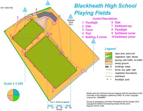
There are 3 common types of courses that you will find useful when setting your first full course. The ‘cross country’ course is where the pupils follow a set course in numerical order. The second is a ‘score’ course where they have to find a number of controls within a set time. The advantage of this course at school is that they can all start at the same time. Finally, there is a ‘relay’ course where teams of 3 or 4 compete against each other. The first runners start and when they get back they hand over to the second runner and so on. Each of the relay loops may be slightly different courses.
More details about courses can be found on the Beginners page.
How to Plan your own courses
When you have your school orienteering map you will need to draw up a number of courses and exercises on the base map.
This is easiest done by using a piece of free software called Purple Pen which can be downloaded from: http://purplepen.golde.org/
Purple Pen requires you to have a copy of your map installed as a background map and the pdf file of your map is compatible.
Below there are links to three videos to help you get to grips with Purple Pen.
Part 1 - Covers setting up your pdf file in Purple Pen
Part 2 - Covers setting up your school POC in Purple Pen
Part 3 - Covers setting up courses in Purple Pen.
These videos have been produced quite quickly as many schools are now using Purple Pen and they will be ‘refined’ over the coming months.
When using Purple Pen it automatically sets up the basic control description sheet on the left of the screen. When you have placed all your controls you will need to complete the description boxes. These boxes are completed by using the inbuilt International Orienteering Federation (IOF) Symbols. These are necessary so that wherever you orienteer in the world the symbols are the same and therefore the map easily understood.
When you place the control description box on your map you can have it displayed in symbol format, text format or both for your pupils to understand.
Download a PDF of the IOF control descriptions
For further information please contact schools@dfok.co.uk